From Wikipedia, the free encyclopedia
This is a list of listed buildings in the parish of Strachur in Argyll and Bute , Scotland .
Name
Location
Date Listed
Grid Ref. [ note 1] Geo-coordinates
Notes
LB Number [ note 2]
Image
Strachur Home Farm
56°10′06″N 5°04′36″W / 56.168286°N 5.076528°W / 56.168286; -5.076528 (Strachur Home Farm ) Category B
18181
Upload Photo
Invernoaden, Lauder Memorial
56°08′03″N 5°01′29″W / 56.134096°N 5.024665°W / 56.134096; -5.024665 (Invernoaden, Lauder Memorial ) Category C(S)
50467
Upload another image See more images
Strachur Inn (Now Police Station)
56°10′05″N 5°04′08″W / 56.168081°N 5.068907°W / 56.168081; -5.068907 (Strachur Inn (Now Police Station) ) Category B
18179
Upload Photo
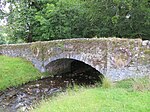
Bridge, (At Home Farm) Strachur Park
56°10′07″N 5°04′36″W / 56.168492°N 5.076577°W / 56.168492; -5.076577 (Bridge, (At Home Farm) Strachur Park ) Category B
19857
Upload Photo
Strachur Kirk
56°10′06″N 5°04′07″W / 56.168267°N 5.068632°W / 56.168267; -5.068632 (Strachur Kirk ) Category B
18178
Upload another image
Glenshellish House And Farm
56°07′52″N 5°02′17″W / 56.131126°N 5.038001°W / 56.131126; -5.038001 (Glenshellish House And Farm ) Category B
19858
Upload another image
Glenbranter Farmhouse Including Bothy, Railings And Gates
56°07′48″N 5°02′37″W / 56.130132°N 5.043668°W / 56.130132; -5.043668 (Glenbranter Farmhouse Including Bothy, Railings And Gates ) Category C(S)
50466
Upload another image
Bridge Strachur Park
56°10′14″N 5°04′22″W / 56.170484°N 5.072757°W / 56.170484; -5.072757 (Bridge Strachur Park ) Category B
18182
Upload another image
Strachurmore Farmhouse
56°09′45″N 5°03′12″W / 56.162417°N 5.053344°W / 56.162417; -5.053344 (Strachurmore Farmhouse ) Category B
18184
Upload Photo
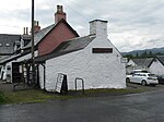
The Smiddy
56°10′01″N 5°04′01″W / 56.166914°N 5.067025°W / 56.166914; -5.067025 (The Smiddy ) Category B
18781
Upload another image See more images
Balliemore, Including Outbuildings And Boundary Walls
56°08′47″N 5°03′22″W / 56.14642°N 5.056084°W / 56.14642; -5.056084 (Balliemore, Including Outbuildings And Boundary Walls ) Category C(S)
18185
Upload Photo
Glenbranter, Bridgend, Bridge Over The River Cur
56°08′15″N 5°02′15″W / 56.137394°N 5.037513°W / 56.137394; -5.037513 (Glenbranter, Bridgend, Bridge Over The River Cur ) Category B
18186
Upload Photo
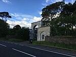
Gate-Way And Gate-Lodge Strachur Park
56°10′16″N 5°04′53″W / 56.17103°N 5.081501°W / 56.17103; -5.081501 (Gate-Way And Gate-Lodge Strachur Park ) Category B
18183
Upload another image
Balliemore Cottage
56°08′54″N 5°03′28″W / 56.148287°N 5.057649°W / 56.148287; -5.057649 (Balliemore Cottage ) Category C(S)
50465
Upload Photo
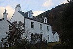
Strachur House
56°10′09″N 5°04′35″W / 56.169133°N 5.076467°W / 56.169133; -5.076467 (Strachur House ) Category B
18180
Upload another image See more images
St Catherines, St Catherines Hotel (Old Ferry Inn)
56°13′22″N 5°01′53″W / 56.222842°N 5.031464°W / 56.222842; -5.031464 (St Catherines, St Catherines Hotel (Old Ferry Inn) ) Category C(S)
49362
Upload another image See more images
Loch Eck, Coire Ealt
56°07′07″N 4°59′59″W / 56.118517°N 4.999658°W / 56.118517; -4.999658 (Loch Eck, Coire Ealt ) Category C(S)
50468
Upload Photo
The scheme for classifying buildings in Scotland is:
Category A : "buildings of national or international importance, either architectural or historic; or fine, little-altered examples of some particular period, style or building type."[ 1] Category B : "buildings of regional or more than local importance; or major examples of some particular period, style or building type, which may have been altered."[ 1] Category C : "buildings of local importance; lesser examples of any period, style, or building type, as originally constructed or moderately altered; and simple traditional buildings which group well with other listed buildings."[ 1] In March 2016 there were 47,288 listed buildings in Scotland. Of these, 8% were Category A, and 50% were Category B, with the remaining 42% being Category C.[ 2]


